Flood Zones, Elevation and Lakefront Lots
A FEMA flood zone is a map designation of flood risk, not a statement about a particular house. Zones starting with A or V are high risk and trigger mandatory flood insurance for federally backed mortgages. Check the address on FEMA's Map Service Center and Manatee County's floodplain tools, ask for an elevation certificate, and get a flood quote before the inspection period ends.
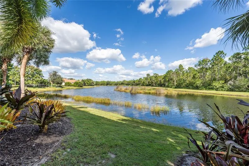
Water arrives in this part of Florida in three ways: from the Gulf during a storm, from the sky in a very heavy rain, and from rivers and creeks that rise after a storm has passed. A flood zone label deals with only part of that. This page explains what the labels mean, how to check an address, what an elevation certificate adds, what the National Flood Insurance Program provides, and what is different about living on a lake or beside a stormwater pond.
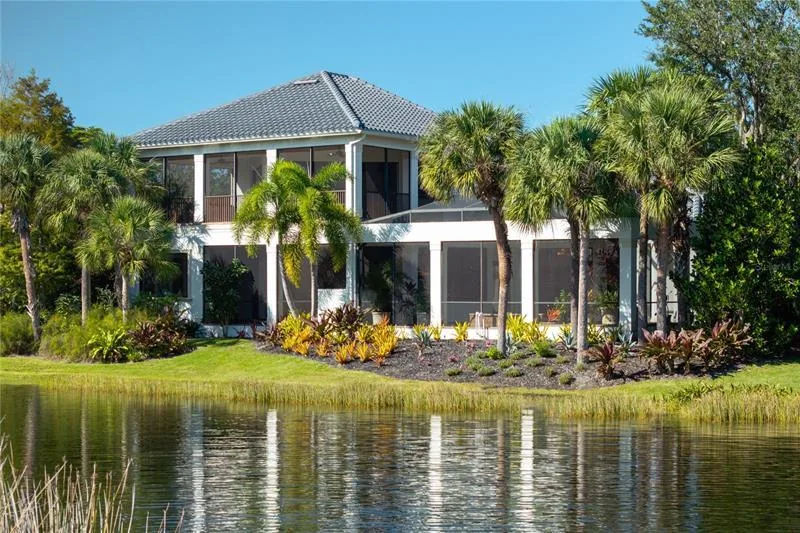
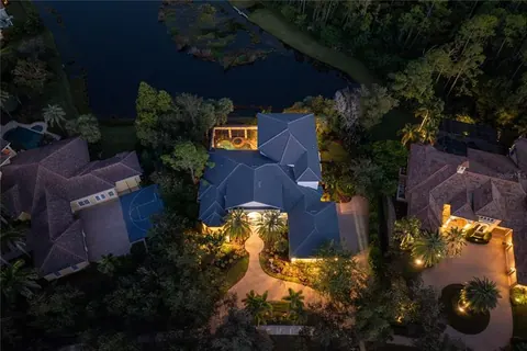
It describes the system, not the zone of any home in The Concession. Flood designations are assigned parcel by parcel, and they change when maps are revised. A buyer considering a specific address, including the lakefront estate at 8305 Farington, should look up that parcel directly and keep a dated copy of the result.
What do FEMA flood zone letters mean?
FEMA publishes Flood Insurance Rate Maps, usually called FIRMs. The National Flood Insurance Program uses them for floodplain management, mitigation and insurance. A FIRM typically shows flood zone designations, base flood elevations, floodplain boundaries, and roads and landmarks.
The central concept is the base flood, which FEMA defines as a flood with a 1 percent chance of occurring in any given year. People call it the 100-year flood, which misleads, because it does not mean it happens once a century. The base flood elevation, or BFE, is the calculated water level expected during that flood.
FloodSmart, the program's consumer site, sorts the zones this way:
- Highest risk: Special Flood Hazard Areas, or SFHAs, usually labeled with an A or a V. The AE designation, used in FEMA's own example, applies where base flood elevations are shown on the map.
- Moderate risk: zone B or shaded zone X.
- Lowest risk: zone C or unshaded zone X, outside the SFHA.
FEMA's tutorial puts it plainly for two common cases. Zone AE is a high-risk SFHA, and homeowners and businesses with federally backed mortgages there must buy flood insurance and follow floodplain rules. Zone X is a moderate-to-low risk area outside the SFHA, where flood insurance is optional and often cheaper.
A caution that FloodSmart repeats: flood maps are not permanent. They are revised to reflect changing risk, so a zone can move up or down. Always record the map's effective date.
How do I check the flood zone for an address?
There are two official routes, and a thorough buyer uses both.
FEMA Map Service Center. The FEMA tutorial walks through it. Go to msc.fema.gov, enter the address and search. The results include a downloadable map excerpt, called a FIRMette, and a link to the National Flood Hazard Layer viewer. Each result lists the map number and effective date, and any changes made to the map since that date.
Manatee County. The county's floodplain page points to its ForeRunner website, which provides flood-related risk data for individual properties, and it has a section for finding elevation certificates and other flood documents for a property. The page lists the Floodplain Management contact as Flood@mymanatee.org and 941-748-4501 ext. 5871, and says the office has moved to 9000 Town Center Parkway in Lakewood Ranch. The county's Resident Information Tool shows flood and evacuation zone information along with shelters and other services for an address.
Print or save the result for the file. If the result shows a high-risk zone, the next step is an elevation certificate. If it shows a lower-risk zone, the next step is still a quote, because the zone is only one input to the price and to the risk.
Is an evacuation level the same as a flood zone?
No, and the confusion is common. Manatee County uses storm evacuation levels labeled A through E, where A is evacuated first. They are based on storm surge, which is the height of saltwater flooding from a hurricane, and they are separate from FEMA-style flood zones. They also do not correspond to a hurricane's category. The county advises checking your level every year, since levels change as new data and coastline changes come in, and if a property falls in two levels, to follow the lower one.
So three different questions have three different tools: the FEMA zone tells you about insurance and floodplain rules, the evacuation level tells you when to leave for surge, and the elevation of the house tells you how it sits relative to water. The hurricane preparedness page covers the evacuation side.
What is an elevation certificate?
FloodSmart describes an elevation certificate as a document comparing a building's height to the expected height of local floodwaters. It records details about the property and building, including the first floor height, which is the height of the lowest floor above the ground, and basements are measured separately.
Insurers use it to judge flood risk. A higher first floor generally means less likelihood of flood damage and can lead to lower premiums, though FloodSmart is careful to say that elevation certificates do not set a rate, they can identify discounts, and a certificate may or may not lower a premium. Most homeowners do not need one to buy flood insurance. The exception is property in a high-risk A zone or a coastal V zone, where one may be needed to verify compliance with local standards.
Where to find one: the local floodplain manager, who works in a county or city building, permitting, engineering or land use department, can say whether a certificate is on file. If none exists, a land surveyor, engineer or architect must prepare it, and the flood insurance agent can recommend one.
For a buyer, three questions follow:
- Does a certificate exist for this house, and is it recent enough to reflect any later construction or grading?
- What does it show for the lowest floor and for any attached garage or lower-level space?
- What did the insurance agent do with it when quoting?
What does flood insurance cost and cover?
The cost is quoted per address, and the page does not publish figures. The structure of the coverage is public:
- Standard homeowners policies do not cover flood. The Florida Department of Financial Services says so directly. A separate policy is required.
- NFIP limits for a residential building. FloodSmart lists up to $250,000 of building coverage and up to $100,000 of contents coverage for homeowners.
- Waiting period. Coverage starts 30 days after purchase. There is no wait if it is bought as part of making, increasing, extending or renewing a mortgage. A one-day wait applies if the property was newly placed in a high-risk zone and the policy is bought within 12 months of that update.
- Same price from every NFIP seller. FloodSmart says NFIP premiums are the same regardless of which provider sells the policy. Non-NFIP flood policies can have different costs.
- How the price is set. For NFIP pricing, FEMA considers flood frequency, flood types, distance to water and building characteristics such as foundation type and elevation. Map data remains essential for communities but is no longer the main driver of premiums.
For a high-value home, the NFIP's building limit of $250,000 may be far below rebuilding cost, which is why buyers in this range often ask about private flood coverage and excess flood coverage. Private policies can have different limits, terms and pricing, and a buyer should read what they exclude. The homeowners insurance page explains how wind and flood policies fit together.
What do lenders require?
Per FEMA's tutorial, a borrower with a federally backed mortgage on a property in a zone such as AE must buy flood insurance. A lender decides whether a property is in a mapped high-risk area and informs the borrower. The FEMA material describes the mandatory requirement for high-risk zones. It says nothing about what a particular lender asks for elsewhere, so a buyer should ask early what the lender will demand and in what amount.
A cash buyer faces no lender requirement but faces the same water. The jumbo loans and cash offers page covers how financing shapes the due diligence timeline. Whether a lender requires it or not, the 30-day waiting period means the policy should be bound before it is needed.
What changes when a home is on a lake or pond?
A lakefront lot raises its own questions beyond the zone letter: rainfall, water levels, drainage and the way the lake itself is managed. The questions are practical, and the answers come from documents and people, not from general rules.
- Who owns and manages the water body? Ask the association, the developer's successor or the relevant district. Determine who controls water levels, who maintains the banks, and who pays.
- Where does the lot's property line end? A survey shows how much of the shoreline, bank and any littoral area belongs to the owner, and any easements for drainage or maintenance.
- What does the lot's drainage do in a heavy rain? Ask the seller about any past water on the lot or inside the house, and ask the association about drainage easements.
- What may be built at the water's edge? Ask whether docks, seawalls, bank landscaping or any change to the shoreline is allowed, and under which declaration provision or permit. See renovations and architectural review.
- What is in the water? The wildlife and preserves page covers what the community's natural areas include. A buyer who has not lived with lakefront wildlife should ask about it on a site visit.
The lot types and views page describes how lots differ, and the luxury home inspections page covers grading, drainage and moisture checks.
What does recent local flooding say about rain and rivers?
A flood zone map is not a history. The National Hurricane Center's report on Hurricane Debby describes major to historic flash and river flooding in Sarasota and Manatee counties in August 2024. In Manatee County it reports over 160 buildings with major damage, officials' estimates of over $55 million in damage, and more than 200 high-water rescues, especially in the Parrish area. The Manatee River at Rye Bridge set a record crest. The report treats this as freshwater flooding from rainfall, with the highest total in the state, almost 17 inches, in Sarasota.
The center's report on Hurricane Ian in 2022 notes that Manatee and Sarasota counties saw significant flooding when the Peace, Myakka and Alafia rivers and Horse Creek reached record crests. These events are a reason to read a flood report as one input rather than the whole picture. They do not say anything about a particular lot in The Concession, so a buyer should ask about the specific history of the address, and should check whether any past damage was reported and repaired. The storm-by-storm record is on the hurricane preparedness page.
What is the 50 percent rule, and why does it matter after a storm?
Manatee County's floodplain page describes substantial improvement as work that, over a one-year period, adds up to at least half of a building's market value before the work began. If a structure has sustained substantial damage, the page says that any repairs are treated as substantial improvement regardless of the work actually performed. In practice this can require bringing the building into compliance with current floodplain rules.
The county says it accepts only an Actual Cash Value approach for the valuation used in a substantial damage determination and will not accept appraisals that use a sales comparison approach. A homeowner dealing with a damaged house should contact Floodplain Management early. For a buyer, the rule is a reason to ask whether the home has been previously damaged and whether any county determination was made.
What should a buyer do?
- Pull the FEMA map result and the county's property flood information for the address, and save both with dates.
- Ask for any elevation certificate, and if none exists, ask an agent whether one would change the quote.
- Get a flood quote from the NFIP and at least one private source before the inspection period ends.
- Ask the lender what it will require and when it needs proof.
- Ask the seller and association about water history, drainage and lake management.
- Keep the result with the closing documents, because maps change.
Flood facts on this page come from the agencies listed and were read in November 2026. Confirm the current zone, map date and rules for any address directly with FEMA, Manatee County and an insurance agent.
Questions people ask
How do I find the flood zone for a specific address?
Enter the address at the FEMA Map Service Center at msc.fema.gov, which returns the map number, its effective date and a downloadable map excerpt. Manatee County also publishes a property flood risk lookup on its floodplain page and a Resident Information Tool. Zone designations can change when maps are revised, so note the effective date of what you find.
Is an evacuation level the same as a flood zone?
No. Manatee County states that evacuation levels A through E are based on storm surge and are separate from FEMA-style flood zones, and they do not correspond to hurricane category. A home can be outside every evacuation level and still be in a flood zone, or the reverse. Check both for any address you are considering.
Do I need flood insurance if the home is not in a high-risk zone?
It is optional in Zone X, often at lower cost, but the lender decides for a mortgage and a cash buyer decides alone. FEMA's flood maps are revised over time, and heavy rain can flood areas outside the mapped high-risk zones. Since homeowners policies exclude flood, get a quote and compare it with the cost of an uninsured loss.
What is an elevation certificate and who prepares one?
It is a document that compares a building's lowest floor height with expected local flood elevation. If none is on file, a land surveyor, engineer or architect prepares one. FloodSmart says the certificate does not set the rate but can identify discounts. Ask the seller and the county floodplain office whether one already exists for the property.
Does the flood insurance waiting period affect a buyer?
Yes. FloodSmart states NFIP coverage starts 30 days after purchase, with no wait when it is bought as part of making, increasing, extending or renewing a mortgage. A cash buyer with no mortgage generally faces the 30 days, so start the quote early rather than waiting until closing.
Sources checked
- FEMA, How to Read a Flood Insurance Rate Map
- FloodSmart Agents, Understanding Flood Maps and Zones
- FloodSmart, Get an Elevation Certificate
- FloodSmart, Buy a Flood Insurance Policy
- Manatee County, Floodplain Management
- Manatee County Emergency Management, Evacuation Levels
- Florida Department of Financial Services, Homeowners Insurance Overview
- NHC Tropical Cyclone Report, Hurricane Debby (AL042024)
Want to see The Concession in person?
A private tour takes about an hour and covers the community, the lots and the homes that fit what you are looking for.